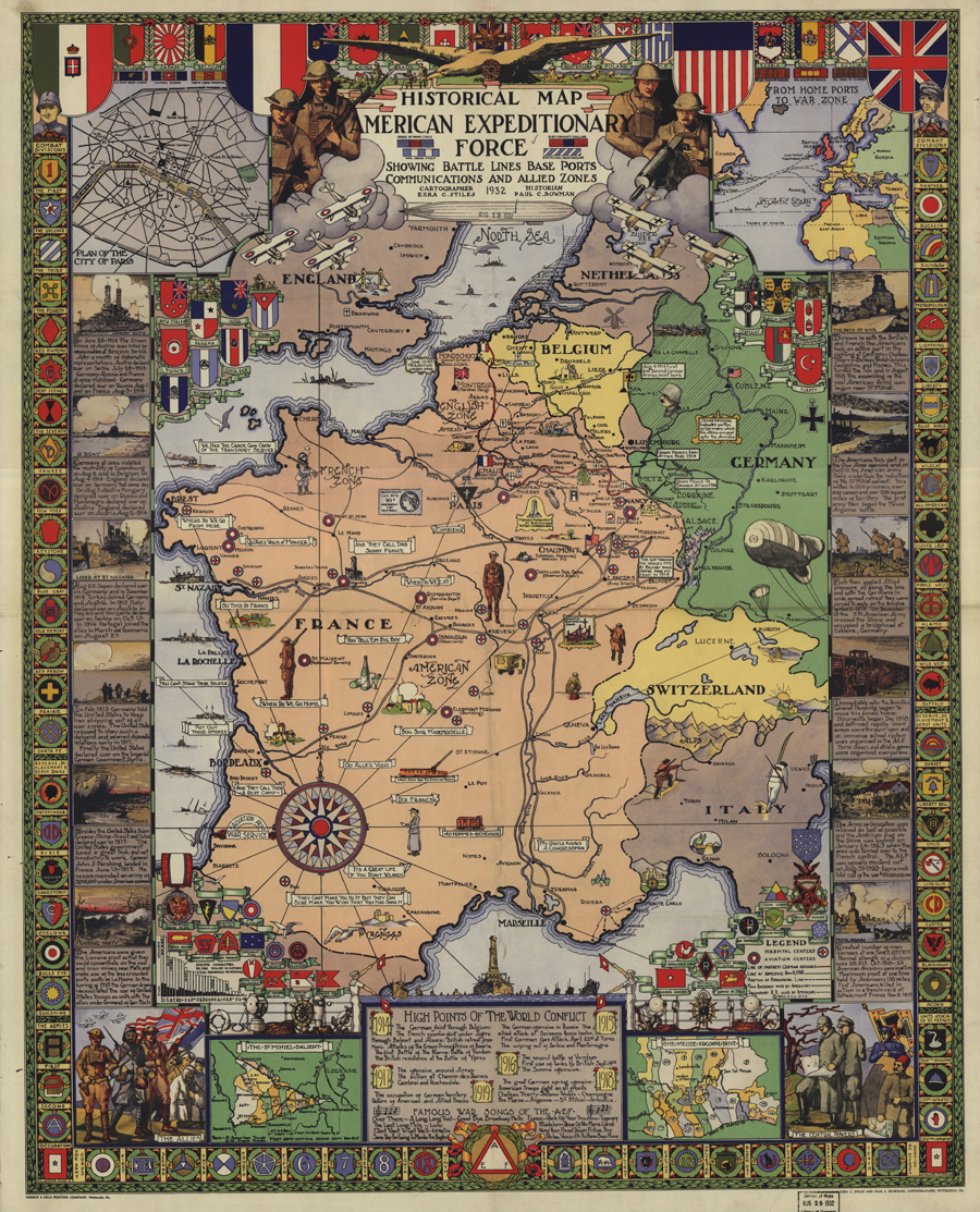
Guided Primary Source Analysis: American Expeditionary Force map
The Americans who participated in the liberation of France were shocked by the devastation and the suffering of French civilians who had lost their homes, their livelihood, and their lives during the war. The compassion of the soldiers of the American Expeditionary Forces for the French people generated many popular songs such as “The Tale…