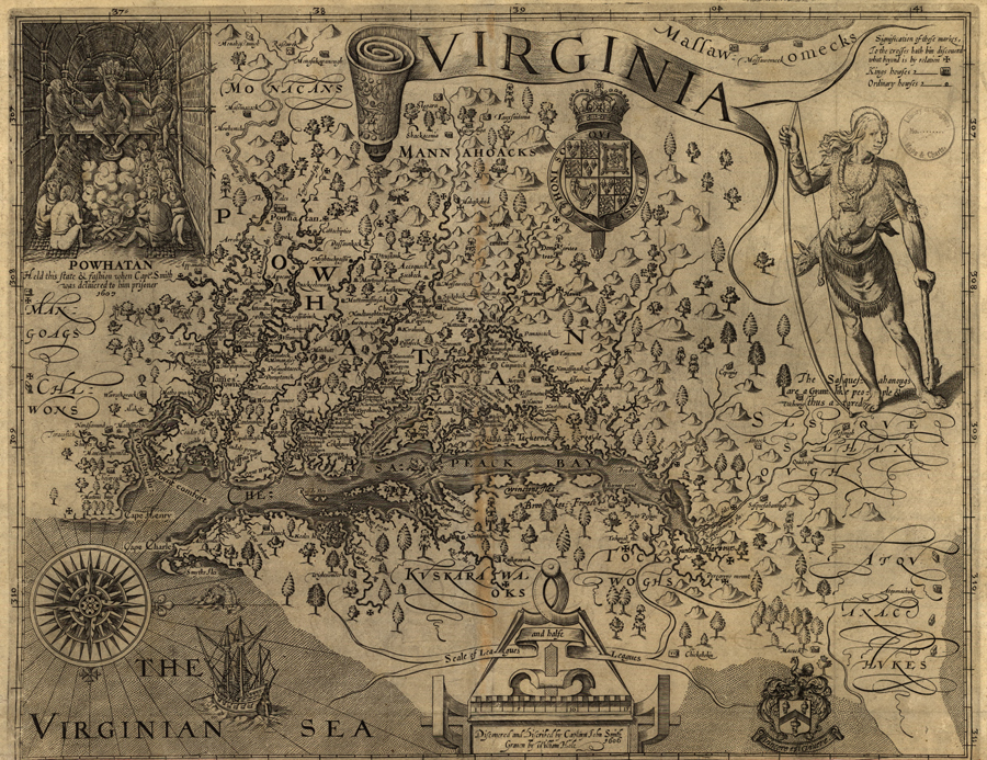
Guided Primary Source Analysis: Virginia by Capt. John Smith

Use the zoom feature online or access a larger image of this map (zoomable map | enlarged map). What details do you notice first? What else strikes you as interesting? Why do you think John Smith made this map?
What scale is used for this map? What scale is typically used for maps today?
The map identifies the Virginian Sea. Does this sea exist? If so, where is it? If not, what is this body of water called?
What other observations, reflections or questions does this source inspire? Let us know!
