Grand Canyon

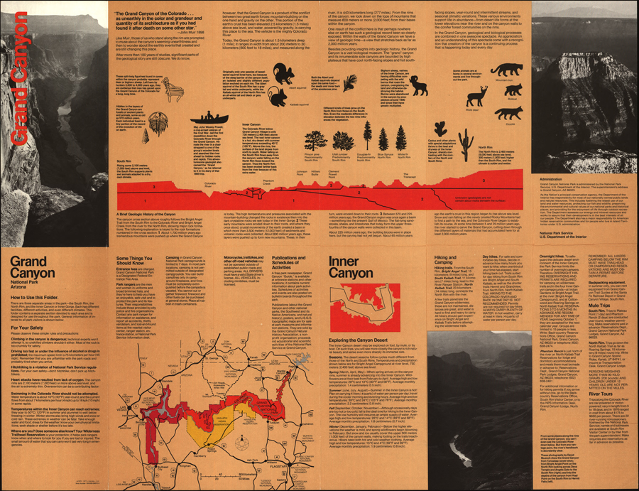
Guided Primary Source Analysis: Grand Canyon Tourist Map

List the different data you find on this map (view larger image). Conduct research to compare the data from this map from 1977 with current information and statistics. What similarities and differences did you find? Investigate reasons for the change(s) in data; describe your findings. What other observations, reflections or questions does this source inspire? Let…

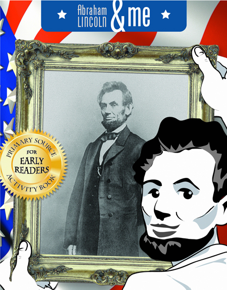
Abraham Lincoln & Me Primary Source Activity Book

Learning from the Source: Abraham Lincoln & Me Activity Book

Students are active learners when they are engaged in real activities. The Abraham Lincoln & Me Primary Source Activity Book enables students to become familiar with primary sources and learn about Abraham Lincoln and his accomplishments while fostering a personal connection to this U.S. president. The activity book is available in English and Spanish with accompanying audio…

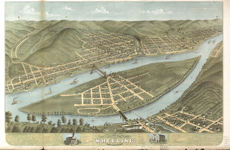
Bird's eye view of the city of Wheeling, West Virginia 1870

Today in History: Albert Ruger

Today in History–November 12–the Library of Congress features mapmaker Albert Ruger, who died on this day in 1899. Ruger was one of the first panoramic map artists to achieve success for his birds-eye views of places. Learn more about his craft by visiting the Today in History section and clicking the links below. Albert Ruger maps Panoramic map artists &…

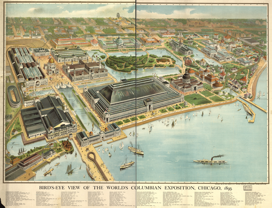
Bird's eye view of the World's Columbian Exposition, Chicago, 1893

Guided Primary Source Analysis: 1893 World’s Columbian Exposition

Which U.S. states had buildings at the 1893 World’s Columbian Exposition in Chicago? Label them with their state abbreviations on the map. Describe 10 objects you see on the map; on another page, note the location of each object (hint: use the map coordinates). Pass your object description list to someone and challenge that friend to…

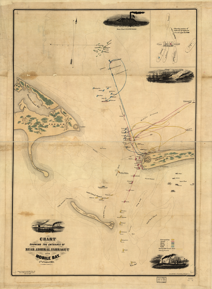
Chart showing the entrance of Rear Admiral Farragut into Mobile Bay 5th of August 1864

Guided Primary Source Analysis: Admiral Farragut Enters Mobile Bay

Zoom into this map (online | .pdf) and use the primary source analysis tool (digital | paper) to analyze this source. Read “Damn the Torpedoes!” from the New York Times Disunion series, then take another look at this map. Explain new insights into this map that you gained. Analyze another primary source related to the 1864 Battle of…

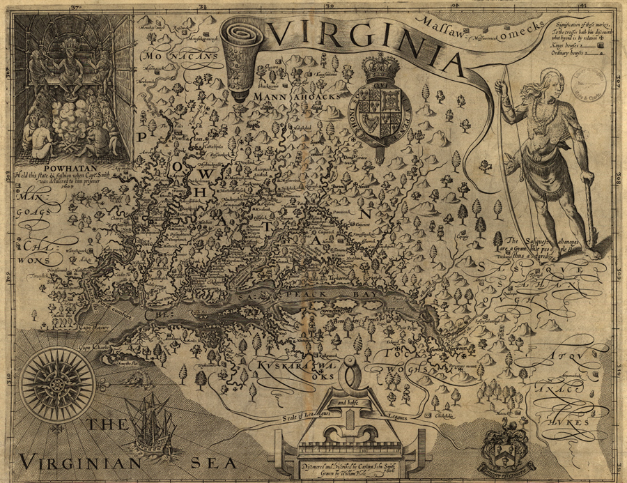
Virginia / discovered and discribed by Captayn John Smith

Guided Primary Source Analysis: Virginia by Capt. John Smith

Use the zoom feature online or access a larger image of this map (zoomable map | enlarged map). What details do you notice first? What else strikes you as interesting? Why do you think John Smith made this map? What scale is used for this map? What scale is typically used for maps today? The map…

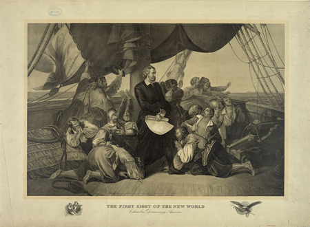
The first sight of the new world - Columbus discovering America

Today in History: Christopher Columbus

Today in History–August 3–the Library of Congress features Christopher Columbus, who set sail for what would later be known as the new world on this day in 1492. Columbus had the most modern maritime tools on his ship, including a mariner’s compass, an astrolabe, a cross-staff, and a quadrant and, quite possibly, the popular mariner map Ptolemy’s Geography or Cosmography. A little…

Indian territory [1887]: compiled from the official records of the records of the General Land Office and other sources under supervision of Geo. U. Mayo.

Learning from the Source: Indian Territory Resettlement

In his article, “Thinking Like an Historian“, from the TPS Quarterly archive (now the TPS Journal), Sam Wineburg points out how many students’ view of history—memorization—diverges from that of historians—investigation—and offers advice for using primary sources to engage students in the “historical approach”. Doing so will help students make more authentic and lasting connections to important…

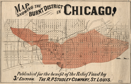
Map Showing The Burnt District In Chicago : Published For The Benefit Of The Relief Fund

Analyzing Primary Sources: Learning from Maps

Oh, the wonderful worlds we discover when we look at maps! The original infographics, maps help us visualize places, features, activities, distributions, routes, and more. The Common Core English Language Arts Standards (CCSS) consider maps a type of informational text for grades K-5 and the analysis of primary source maps is particularly emphasized in CCSS Reading Anchor Standard 7—Integrate and…

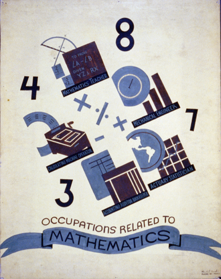
Primary Source Learning: Math Activities That Add Up

Primary Source Learning: Math Activities That Add Up

Integrating primary sources into the social studies curriculum doesn’t take a quantum leap of imagination, but can you imagine how they could be paired with math? Numerous teachers who have gone through Teaching with Primary Sources programs delivered by TPS consortium members, have done just that. Intrigued? Check out their formulas for mathematical learning by…

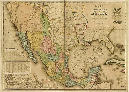
(Map of the area used for the negotiations.)

Today in History: Treaty of Guadalupe Hidalgo

Today in History–February 2–the Library of Congress features the Treaty of Guadalupe Hidalgo, signed on this day in 1848. The treaty ended the United States’ war with Mexico and extended the U.S. western boundary to the Pacific ocean. Learn more by visiting the Today in History section, then click the links below to discover more about this war between the…