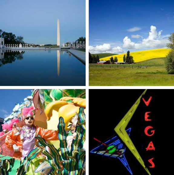
Primary Source Spotlight: U.S. Military Conscription (the Draft)

Primary Source Spotlight: U.S. Military Conscription (the Draft)

The Draft Riots of 1863 : A Historical Study Read at the Meeting of the Ohio Commandery Civil War draft riots Civil War induction officer with lottery box photograph Civil War Conscription Laws In Custodia Legis November 15, 2012 Freemen! Avoid Conscription! 1862 broadside Abraham’s draft, 600,000 more 1862 sheet music Southern “volunteers” 1862 political…

Finding Resources: Postcards

Finding Resources: Postcards

Postcards: Greetings from the Prints & Photographs Division Research Guide Selected collections Panoramic and oversized postcards Postcards of Native Americans Postcards of churches in the United States Postcards of churches outside the United States Postcards of scenic views and tourist attractions Advertisement postcards Search tips Reference works Related resources Africana Historic Postcard Collection Democratic Republic…

Timely Connections: Border Spaces Across Time

Timely Connections: Border Spaces Across Time

In a blog post titled, “Comparing Primary Sources Depicting Border Spaces” Library of Congress 2019 Hispanic Division Junior Fellow Jaime Conlan provides insight into using historical and contemporary photographs to serve as an important entryway to discuss difficult issues relevant to the curriculum and, ultimately, to better understand Mexico/U.S. border space. Read the full blog…

Primary Source Spotlight: Influenza

Primary Source Spotlight: Influenza

Early influenza sources An address of thanks from the faculty to the Right Honble, Mr. Influenzy for his kind visit to this country 1803 An account of the origin, symptoms, and cure of the influenza or epidemic catarrh 1832 Kartogramma “grippa”, oktiabrʹ 1889-mart 1890 shows occurrence of influenza by province (Russia) Influenza pandemic 1918-1919 Rampaging…

Guided Primary Source Analysis: Diagramming the Federal Government

Guided Primary Source Analysis: Diagramming the Federal Government

Zoom into a detailed view of this diagram. Read the text and carefully review the data. Create a bulleted list of the information you learned from the diagram. What does the text in the third column say is the purpose of this diagram? Do you think the diagram fulfills this purpose? Why or why not?…

Today in History: War of 1812

Today in History: War of 1812

Today in History–June 18–the Library of Congress features the War of 1812. On this date in 1812 President James Madison signed a declaration of war against Great Britain. Reasons for the war included frustration with Britain’s maritime practices and their support of Native American resistance to western expansion as well as a desire to conquer Canada. The war lingered on…

Guided Primary Source Analysis: Has the war ruined the country?

Guided Primary Source Analysis: Has the war ruined the country?

Read the headline and the four lines of text just under the headline. Then look at the footer text at the bottom of this page. Who do you think was the audience for this broadside? Explain the reasoning behind your conclusion. (Hint: If you need help answering this, there is one particular word that you should…

Guided Primary Source Analysis: Eagle map of the United States

Guided Primary Source Analysis: Eagle map of the United States

Zoom into this map (online | .pdf). How many states do you see? Describe the differences between this 1833 map and a current map of the United States. What impression of the United States do you get from this map? Explain your reaction. Then use details from the source to explain what might have been the…

Guided Primary Source Analysis: States & Territories in Population

Guided Primary Source Analysis: States & Territories in Population

Review the complete document: “Statistical atlas of the United States, based upon the results of the eleventh census” H/T to educator extraordinaire, Cheryl Davis, aka @digitalteacher Which state had the biggest population growth according to this chart? Which region (Northeast, Southeast, Midwest, Northwest, Southwest) had the biggest population gains during these 100 years? What other trend(s) can you…

Guided Primary Source Analysis: Nicknames of the States

Guided Primary Source Analysis: Nicknames of the States

Which states/territories were not given nicknames? How many states are represented on this? Are there any U.S. states not found on this map? How much would it have cost for you to buy this map in 1884? Why is there an image of one or more pigs on every state? Use these state primary source collections to find out more about one…

Guided Primary Source Analysis: Robertson’s Geographic-Historical Series

Guided Primary Source Analysis: Robertson’s Geographic-Historical Series

Who do you think is pictured on the cover of this atlas? Why do you think that? How many years does this atlas cover? Review the list of pages below and choose one title to investigate further. Click the image above to access the digital pages. What did you discover about the topic and time…