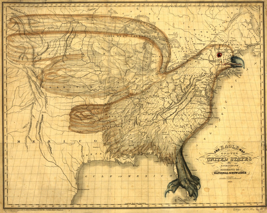
The eagle map of the United States

Guided Primary Source Analysis: Eagle map of the United States

Zoom into this map (online | .pdf). How many states do you see? Describe the differences between this 1833 map and a current map of the United States. What impression of the United States do you get from this map? Explain your reaction. Then use details from the source to explain what might have been the…

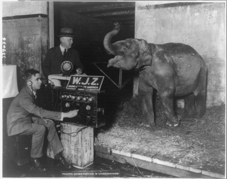
Circus broadcasted by radio for first time

Guided Primary Source Analysis: Circus Radio Broadcast

Imagine you are the elephant. What is your “song” about? Create speech or thought bubbles for the two men and the elephant in this picture. How could we broadcast the elephant’s “song” today? What kind of equipment would we use? How is that similar to and different from the equipment used in this image? What…

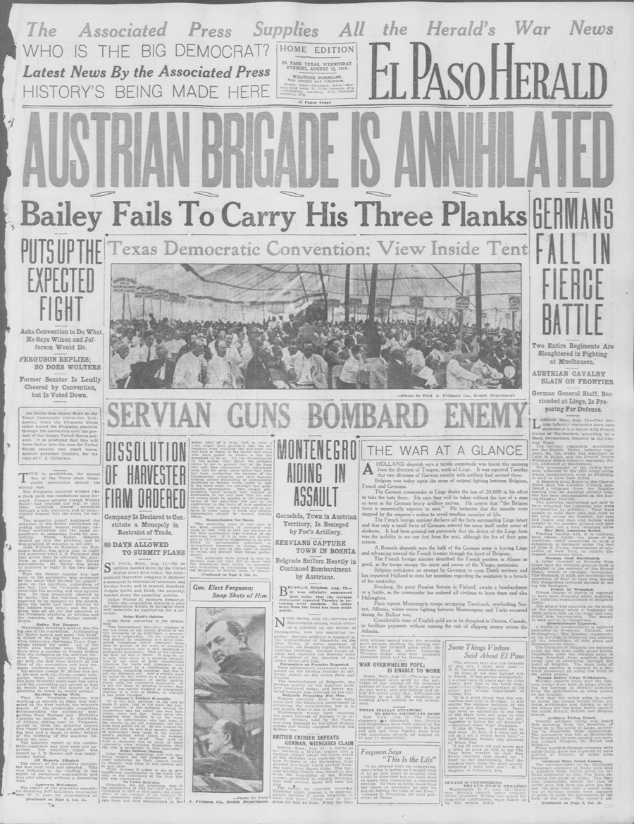
El Paso herald. (El Paso, Tex.), 12 Aug. 1914

Guided Primary Source Analysis: El Paso Herald August 12, 1914

Zoom into this newspaper (online | .pdf). What is the most important topic on this page? What details support your conclusion? There is a question in the newspaper’s nameplate, or top, section. What is the question and what do you think is the answer to the question? What details support your answer? What information about El…

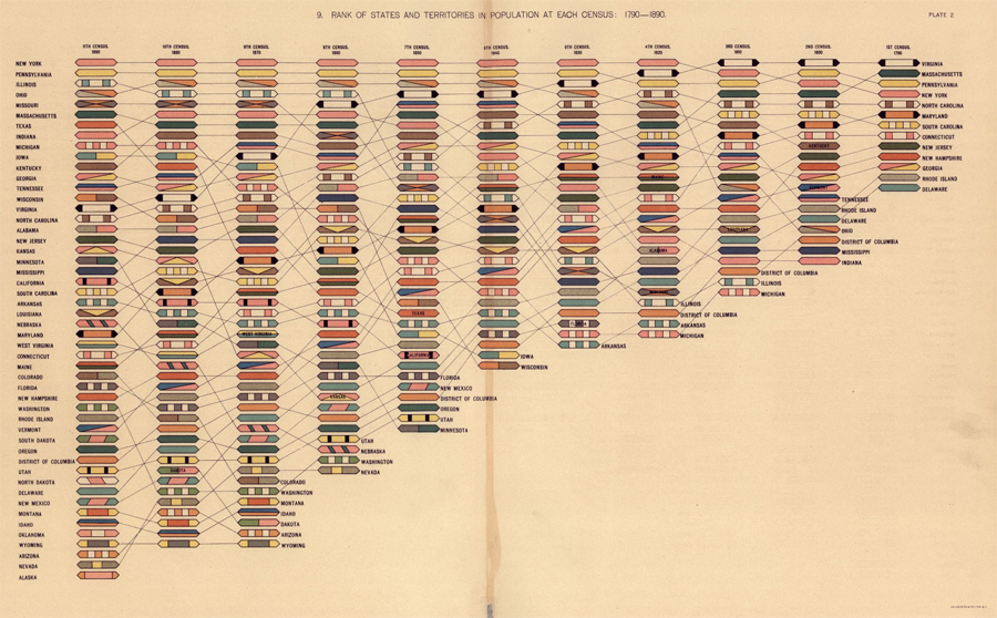
Rank of Territories and States in Population at Each Census: 1790-1890

Guided Primary Source Analysis: States & Territories in Population

Review the complete document: “Statistical atlas of the United States, based upon the results of the eleventh census” H/T to educator extraordinaire, Cheryl Davis, aka @digitalteacher Which state had the biggest population growth according to this chart? Which region (Northeast, Southeast, Midwest, Northwest, Southwest) had the biggest population gains during these 100 years? What other trend(s) can you…

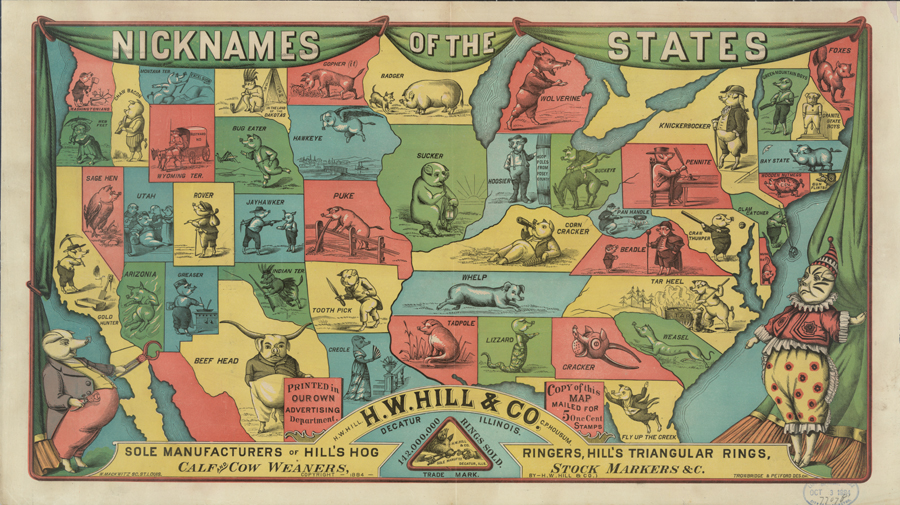
Nicknames of the states.

Guided Primary Source Analysis: Nicknames of the States

Which states/territories were not given nicknames? How many states are represented on this? Are there any U.S. states not found on this map? How much would it have cost for you to buy this map in 1884? Why is there an image of one or more pigs on every state? Use these state primary source collections to find out more about one…

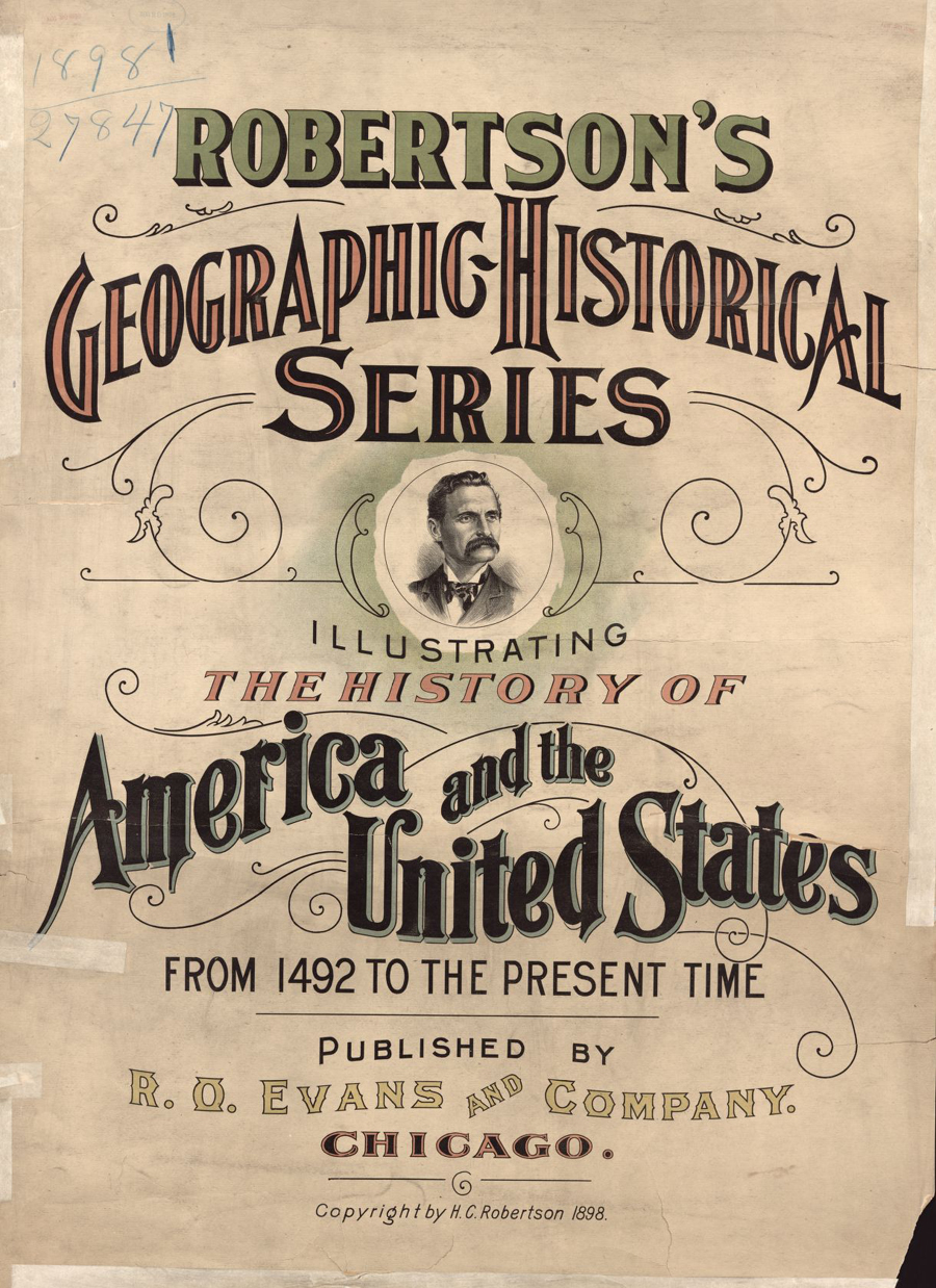
Robertson's geographic-historical series

Guided Primary Source Analysis: Robertson’s Geographic-Historical Series

Who do you think is pictured on the cover of this atlas? Why do you think that? How many years does this atlas cover? Review the list of pages below and choose one title to investigate further. Click the image above to access the digital pages. What did you discover about the topic and time…

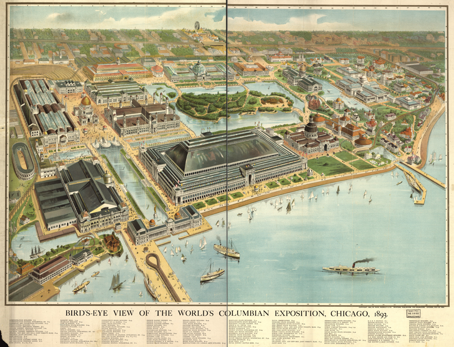
Bird's eye view of the World's Columbian Exposition, Chicago, 1893

Guided Primary Source Analysis: 1893 World’s Columbian Exposition

Which U.S. states had buildings at the 1893 World’s Columbian Exposition in Chicago? Label them with their state abbreviations on the map. Describe 10 objects you see on the map; on another page, note the location of each object (hint: use the map coordinates). Pass your object description list to someone and challenge that friend to…

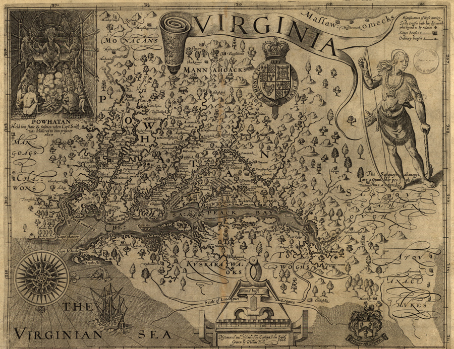
Virginia / discovered and discribed by Captayn John Smith

Guided Primary Source Analysis: Virginia by Capt. John Smith

Use the zoom feature online or access a larger image of this map (zoomable map | enlarged map). What details do you notice first? What else strikes you as interesting? Why do you think John Smith made this map? What scale is used for this map? What scale is typically used for maps today? The map…

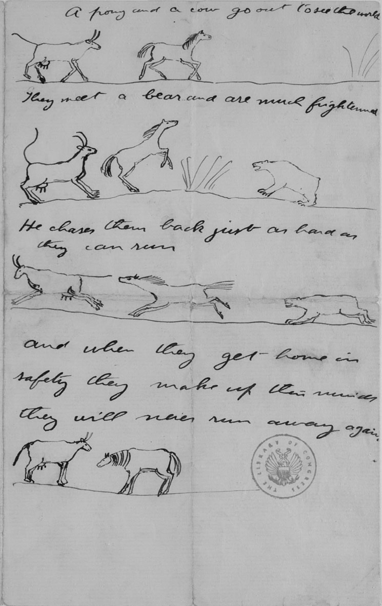
Letter with illustrated fable, Theodore Roosevelt to Theodore Roosevelt, Jr., 11 July 1890.

Guided Primary Source Analysis: Lessons for My Community

  This source is listed as a letter with illustrated fable. What is the moral or lesson of the story? Read more about the author and recipient of this letter. What interesting information did you uncover? Write and illustrate your own brief fable that contains a lesson useful for your school or local community. What…