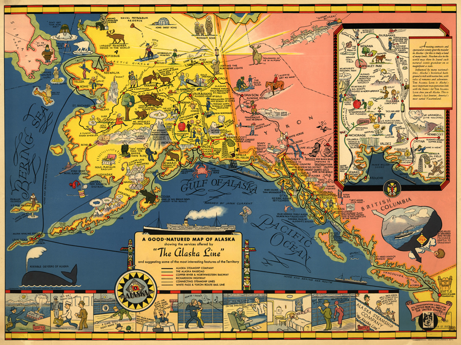
Guided Primary Source Analysis: The Alaska Line

For each of the following questions, use specific details from the map to support your conclusions (zoom into this map online or download a larger image). Who created this map? How do you know? Why do you think this map was created? Who do you think the audience might have been when it was published in 1934?
How many different transportation lines are represented on this map? How many different modes of transportation are represented? Choose two points (look for the red points and find the associated names) on the map and challenge a friend to tell you which modes of transportation and which transportation lines a person would need to use in order to get from one point to the other.
Choose one interesting fact represented on this map that would be possible to investigate further. Is the information still true today? What else did you learn about this area or feature?
What other observations, reflections or questions does this source inspire? Let us know!
