Oh, the wonderful worlds we discover when we look at maps! The original infographics, maps help us visualize places, features, activities, distributions, routes, and more. The Common Core English Language Arts Standards (CCSS) consider maps a type of informational text for grades K-5 and the analysis of primary source maps is particularly emphasized in CCSS Reading Anchor Standard 7—Integrate and evaluate content presented in diverse media and formats, including visually and quantitatively, as … [Read more...]
You are here: Home / Archives for standard 7
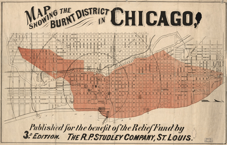
Analyzing Primary Sources: Learning from Maps
Filed Under: Teaching & Learning Tagged With: analysis, analysis prompts, analysis tool, analyzing primary sources, anchor reading standards, aps, cartographic, cartography, ccss, ccssi, chicago fire, collaborative digital library collections, common core state standards, digitized maps, ela, exhibitions, geographic, Geography, guiding questions, infographic, informational text, map, maps, primary source, primary source analysis tool, standard 7, teaching and learning, teaching learning, teaching with primary sources, TL, tps, world, world digital library